
Emerald Beach Resort beach & sargassum forecast
Charlotte Amalie, St. Thomas, VI · U.S. Virgin Islands, U.S. Virgin Islands · 18.335, -64.964
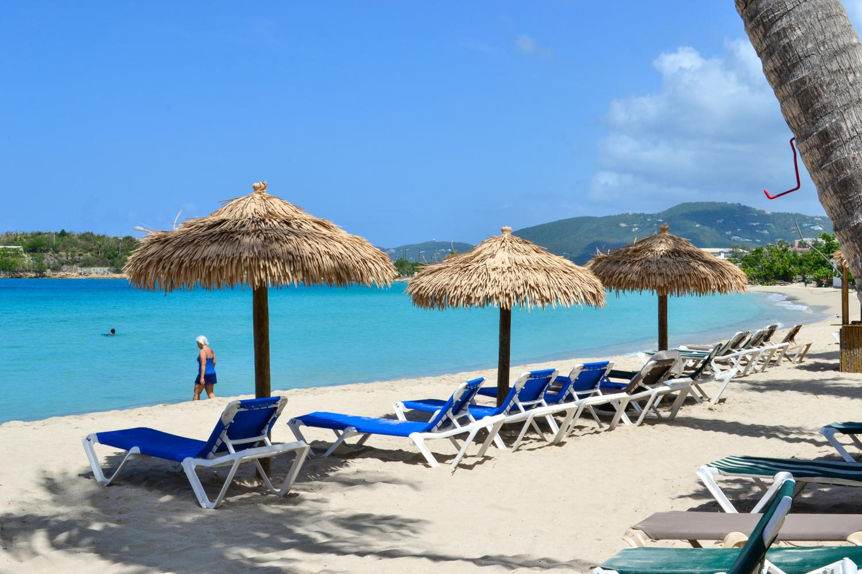
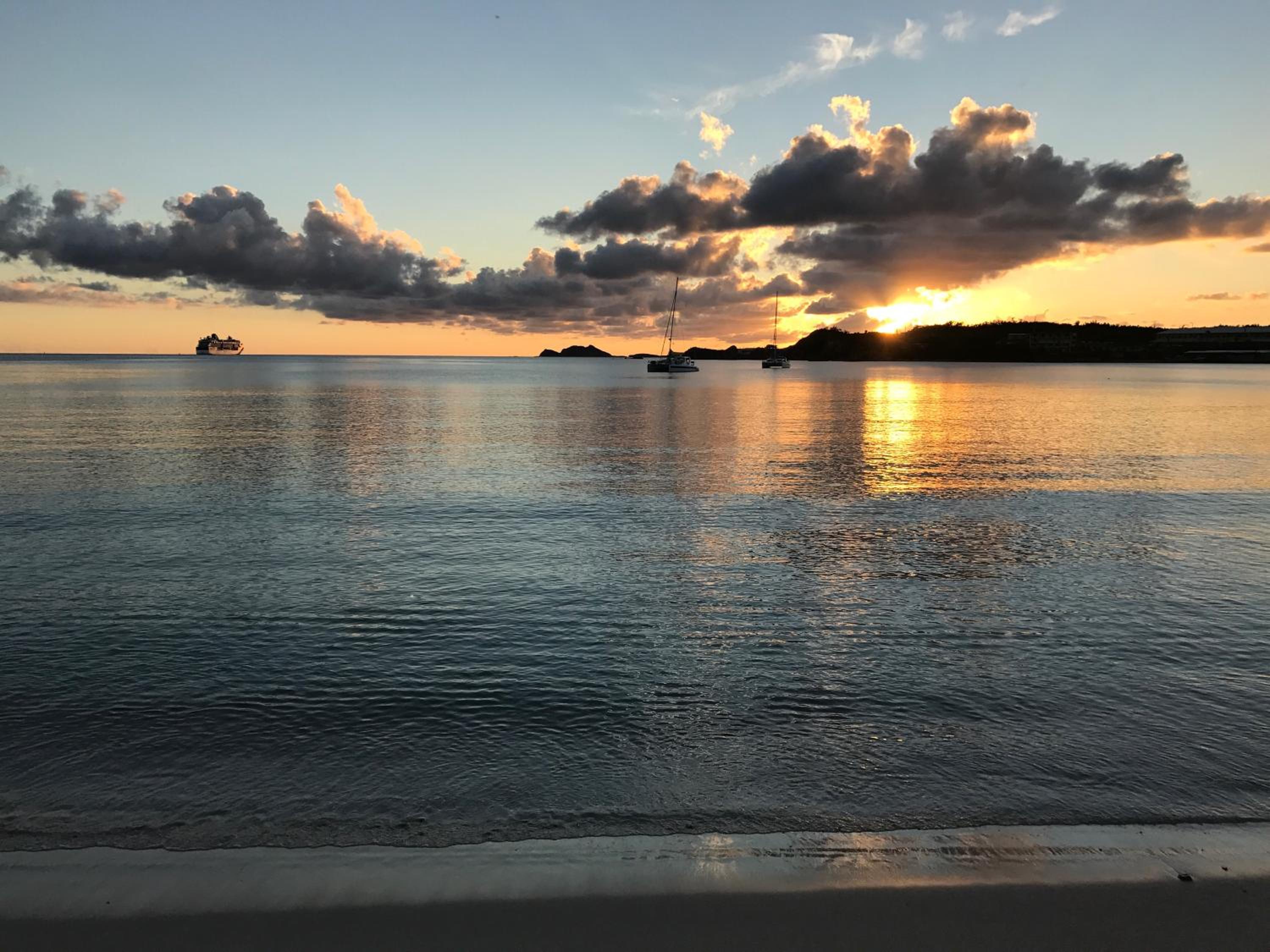
Updated : low seaweed, beach grade B, sea 85°F.

Veabird's call
Friday is the day to go: A- with little seaweed and 85°F water.
April and May grade best, and seaweed is usually lowest in July.
Grades from Veabird's beach forecast; wording by AI (Muse Spark), checked against the forecast. Updated Nov 19, 01:00 UTC.
Tell me when Emerald Beach Resort is clear
One email when the seaweed clears or the beach grades A, at most once a week per beach. We only ask for your email address, and every email has a one-click unsubscribe.
We email you a link to confirm first. Privacy
Plan your trip
Where to stay nearby
Partner links: Veabird may earn a commission at no cost to you. Partners never affect forecasts or scores.
Questions about Emerald Beach Resort
Does Emerald Beach Resort get sargassum (seaweed)?
Only a little in most years. At Emerald Beach Resort the typical-year risk stays low, even around July, the usual peak (moderate or heavier seaweed on the beach in an estimated 10% of weeks). Landings vary by year, wind and currents.
How warm is the water at Emerald Beach Resort?
About 84°F in November. The sea is warmest in September and October (about 86°F) and coolest in February and March (about 80°F).
When is the best time to visit Emerald Beach Resort?
For warm water and dry weather, aim for January through June. June is usually the quietest of those, with about 11 rainy days and a sea near 84°F.
When is hurricane season at Emerald Beach Resort, and how often do storms hit?
The Atlantic hurricane season runs June through November and peaks around September. A tropical storm passed within 86 miles of Emerald Beach Resort in 24 of the 55 seasons from 1971 to 2025, and a hurricane within 58 miles in 7. The riskiest stretch is around August 27, when the chance of a storm passing in any one week is about 6%; across all of September it is about 17%. Flexible bookings and travel insurance help in the peak weeks.
What guests say about Emerald Beach Resort
Guests like Great location · Friendly staff
Watch for Cleanliness issues · Poor food quality
- Cleanliness
6.8 - Service
8.3 - Location
9.3 - Room Quality
6.8 - Amenities
7.8 - Value for Money
7.2 - Food and Beverage
5.3 - Overall Experience
7.8
Read all 1,004 reviews · Compare on Expedia
Scores and reviews come from guests who stayed, through LiteAPI (Nuitée). The likes, watch-fors and category scores are an AI summary of those reviews. Partner links: Veabird may earn a commission.
Sargassum season at Emerald Beach Resort
Low sargassum risk year-round at Emerald Beach Resort: even around July, the usual peak, Veabird estimates moderate or heavier seaweed on the beach in about 10% of weeks. Actual landings vary a lot by year, wind and currents; check the live conditions above.
Estimated share of weeks in each month with moderate or heavier seaweed on the beach. Veabird takes the landing season seen on Quintana Roo's beaches (a Puerto Morelos beach camera, 2015–2020, and the Mexican Navy's beach alerts, 2022–2026), the nearest coast with a multi-year beach record (this one has none), and scales it by how often NOAA AOML satellites see notable seaweed within about 20 km of this stretch of coast: 8% of weeks here on average, against 54% off Quintana Roo, so 15% of that season. The satellite share (2016–2024, the top fifth of all coast-weeks, adjusted for this beach's exposure of 30%) measures seaweed offshore, not on the sand: off the Riviera Maya it reads high even in winter, when little lands. Very low under 10%, Low 10–24%, Moderate 25–44%, High 45–69%, Very high 70%+. Beach faces 225°; onshore winds from that direction push seaweed ashore. Satellite sargassum data: USF Optical Oceanography Lab (Sargassum Watch System) via NOAA AOML. The satellite record as open data.
The US Virgin Islands month by month
Typical weather, water temperature, seaweed and crowds for every month: the best time to visit the US Virgin Islands.
- The US Virgin Islands in January
- The US Virgin Islands in February
- The US Virgin Islands in March
- The US Virgin Islands in April
- The US Virgin Islands in May
- The US Virgin Islands in June
- The US Virgin Islands in July
- The US Virgin Islands in August
- The US Virgin Islands in September
- The US Virgin Islands in October
- The US Virgin Islands in November
- The US Virgin Islands in December
Weather, water & seaweed by month at Emerald Beach Resort
Average highs run from about 79°F in January, February, March and April to 84°F in August, September and October. The sea is warmest in September and October (about 86°F) and coolest in February and March (about 80°F). March is usually the driest, with about 10 rainy days; October is the wettest, with about 17 rainy days.
| Month | Avg high | Sea | Rainy days | Sargassum |
|---|---|---|---|---|
| Jan | 79°F | 81°F | 11 | Very low |
| Feb | 79°F | 80°F | 12 | Very low |
| Mar | 79°F | 80°F | 10 | Very low |
| Apr | 79°F | 81°F | 12 | Very low |
| May | 82°F | 83°F | 12 | Very low |
| Jun | 83°F | 84°F | 11 | Very low |
| Jul | 83°F | 84°F | 14 | Low |
| Aug | 84°F | 85°F | 15 | Very low |
| Sep | 84°F | 86°F | 15 | Very low |
| Oct | 84°F | 86°F | 17 | Very low |
| Nov | 82°F | 84°F | 16 | Very low |
| Dec | 81°F | 82°F | 13 | Very low |
Monthly averages from 6 years of ERA5 reanalysis (Open-Meteo) for this area's 0.5° grid cell; rainy days have at least 1 mm (0.04 in). Sargassum is the typical-year estimate described above. Any given year can differ.
Cleanup & barriers
- Offshore barriers
- No offshore barriers; occasional booms at a few resorts
- Public cleanup
- Territorial DPNR / hotel crews rake affected beaches; east-end St. Croix and St. Thomas bays hit hardest
- Resort crews
- Large resorts clear frontage daily in season
- Typical clearing time
- Same-day at resorts; public beaches can lag days
Safety notes
US territory - no State Dept advisory (verify local guidance)
- Petty theft and car break-ins; avoid isolated areas at night in Charlotte Amalie and Christiansted
- Drive on the left; steep, narrow roads
- 2017 Irma/Maria showed high hurricane exposure Aug-Oct
Check official advisories and local flags before swimming. Decomposing sargassum releases hydrogen sulfide; avoid heavy piles.
Things to do near Charlotte Amalie, St. Thomas, VI
- Trunk Bay underwater trail (St. John)
- Virgin Islands National Park hikes
- Magens Bay
- Buck Island Reef National Monument
- Christiansted historic district
- Day sail to the BVI
Fly in for the best beach days
Suggested dates are a week in December. Change them to match the live forecast above.
Opens a flight search in a new tab. Partner link: Veabird may earn a commission.
Nearest airports
- Cyril E. King (St. Thomas) (STT), ~1 km
Nearby resorts
- Island Beachcomber Hotel Charlotte Amalie, St. Thomas, VI · 0 km
- Carib Beach Resort Charlotte Amalie, St. Thomas, VI · 1 km
- Virgin Islands Camp Ground Charlotte Amalie, St. Thomas, VI · 2 km
- Windward Passage Hotel Charlotte Amalie, St. Thomas, VI · 3 km
- Crystal Palace Charlotte Amalie, St. Thomas, VI · 3 km
- Frenchman's Reef Marriott (Morning Star Beach) Charlotte Amalie, St. Thomas, VI · 4 km
Embed this forecast
Hotels and travel sites can show live conditions for Emerald Beach Resort for free. Get the widget · Data & API